
Search by Postcode
Map of the best Hotels near the SG13 8PA Postcode in Brickendon Green, Hertford
We have searched high and low to find the best hotels near the SG13 8PA postcode in the historic county of Hertfordshire.
The SG13 8PA postcode is situated in Hertford. We have found hotels nearby.
Use our easy to use hotel map or comprehensive accommodation listings to find the right SG13 8PA hotel for you.
| Zoom Level | Latitude | Longitude |
| 6 | 53.521968 | -2.164306 |
Hotel Deals for SG13 8PA Postcode in Brickendon Green, Hertford
The Nearest Hospitals to SG13 8PA Postcode in Brickendon Green, Hertford
| Hospital Name | Operator | Distance Km | Distance Mi. |
|---|---|---|---|
| Hertford County Hospital | North Road, Hertford, Hertfordshire, SG14 1LP | 4.90 | 3.04 |
| Mental Health Unit QEII | QEII Hospital, Howlands, Welwyn Garden City, Hertfordshire, AL7 4HQ | 7.60 | 4.72 |
| Queen Elizabeth I I Hospital | Howlands, Howlands, Welwyn Garden City, Hertfordshire, AL7 4HQ | 7.60 | 4.72 |
| BMI The Kings Oak Hospital | The Ridgeway, Enfield, Middlesex, EN2 8SD | 9.47 | 5.89 |
Cheap Hotels near the SG13 8PA Postcode in Hertford
The 10 nearest Budget hotels to the SG13 8PA Postcode offering economy accommodation
| Budget Hotel Name | Distance |
|---|---|
| 1:
Travelodge Cheshunt | 8.52 km (5.29 Miles) |
| 2:
Premier Inn Ware | 9.12 km (5.67 Miles) |
| 3:
Premier Inn London Enfield | 11.25 km (6.99 Miles) |
| 4:
Travelodge London Enfield | 12.36 km (7.68 Miles) |
| 5:
Premier Inn Waltham Abbey | 13.54 km (8.41 Miles) |
The Nearest Airports to SG13 8PA Postcode in Brickendon Green, Hertford
| Airport Name | Distance Km | Distance Mi. |
|---|---|---|
| London Luton Airport | 24.44 | 15.19 |
| London Stansted Airport | 28.37 | 17.63 |
| London City Airport | 29.13 | 18.10 |
The Nearest Stations to SG13 8PA Postcode in Brickendon Green, Hertford
| Station Name | Operator | Distance Km | Distance Mi. |
|---|---|---|---|
| Bayford | Govia Thameslink Railway | 0.84 | 0.52 |
| Cuffley | Govia Thameslink Railway | 5.11 | 3.17 |
| Hertford North | Govia Thameslink Railway | 5.17 | 3.21 |
Places to Stay near the SG13 8PA Postcode
Sweetings Wood Glamping
| Sweetings Wood Glamping |
| Distance in Km 0.46 |
 |
| View entry for Sweetings Wood Glamping on Bed Map |
Hertford House
| Hertford House |
| Distance in Km 4.93 |
 |
| View entry for Hertford House on Bed Map |
Dog and Whistle Pub
| Dog and Whistle Pub |
| Distance in Km 5.04 |
 |
| View entry for Dog and Whistle Pub on Bed Map |
Woodland Lodge
| Woodland Lodge |
| Distance in Km 5.06 |
 |
| View entry for Woodland Lodge on Bed Map |
Serviced, Modern, Private flat & garden. Hertford
| Serviced, Modern, Private flat & garden. Hertford |
| Distance in Km 5.11 |
 |
| View entry for Serviced, Modern, Private flat & garden. Hertford on Bed Map |
Hertford Barn conversion
| Hertford Barn conversion |
| Distance in Km 6.31 |
 |
| View entry for Hertford Barn conversion on Bed Map |
Double Room in Cheshunt, near M25 & A10
| Double Room in Cheshunt, near M25 & A10 |
| Distance in Km 6.77 |
 |
| View entry for Double Room in Cheshunt, near M25 & A10 on Bed Map |
Hertford Serviced Apartments (Peymans)
| Hertford Serviced Apartments (Peymans) |
| Distance in Km 7.03 |
 |
| View entry for Hertford Serviced Apartments (Peymans) on Bed Map |
Cheshunt Marriott Hotel
| Cheshunt Marriott Hotel |
| Distance in Km 7.09 |
 |
| View entry for Cheshunt Marriott Hotel on Bed Map |
Beautiful Place
| Beautiful Place |
| Distance in Km 7.49 |
 |
| View entry for Beautiful Place on Bed Map |
The White House
| The White House |
| Distance in Km 7.51 |
 |
| View entry for The White House on Bed Map |
Kingsway Bed & Breakfast
| Kingsway Bed & Breakfast |
| Distance in Km 7.64 |
 |
| View entry for Kingsway Bed & Breakfast on Bed Map |
Tewin Bury Farm Hotel
| Tewin Bury Farm Hotel |
| Distance in Km 7.78 |
 |
| View entry for Tewin Bury Farm Hotel on Bed Map |
Lee Valley Lodge
| Lee Valley Lodge |
| Distance in Km 7.87 |
 |
| View entry for Lee Valley Lodge on Bed Map |
Heather's Lodge
| Heather's Lodge |
| Distance in Km 8.18 |
 |
| View entry for Heather's Lodge on Bed Map |
2-bedroom apartment, Woodgrange Court, Hoddesdon
| 2-bedroom apartment, Woodgrange Court, Hoddesdon |
| Distance in Km 8.42 |
 |
| View entry for 2-bedroom apartment, Woodgrange Court, Hoddesdon on Bed Map |
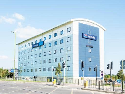
Travelodge Cheshunt
| Travelodge Cheshunt |
| Distance in Km 8.52 |
 |
| View entry for Travelodge Cheshunt on Bed Map |
Velvet 2-bedroom apartment, Brewery Road, Hoddesdon
| Velvet 2-bedroom apartment, Brewery Road, Hoddesdon |
| Distance in Km 8.54 |
 |
| View entry for Velvet 2-bedroom apartment, Brewery Road, Hoddesdon on Bed Map |
Is a Hotel Missing?
Let us know the Name, Address and Postcode and we’ll add it to our listings.
Contact Us